I needed to remind myself a couple of times a day that I had chosen to take the dirt track north to Coober Peddy, and that no one had forced me from the smooth bitumen of the Stuart Highway north. As the heat built during the days of travel north, and the road became harder to read because of the sweat in my eyes, and the bad light of the mid-day sun, I had a number of tank slappers and "oh-shit" moments that made me remember who had decided on this route.
I decided to travel the Oonadatta track as it would take me easterly from the main highway, and as well it would touch upon the country that would be as close to the Burke and Wills path north as I was going to get. Also, the brand new Heideneau rear tire and the TKC 80 front tire needed some dirt to round themselves out, or so I thought. I talked to an old stockman about the route, and aside from warning me about the sand, bulldust, and heat, he said that I should be okay. Hmmn..bulldust: that sounds interesting I said to myself.
I scanned the horizon for Caribou, but not a one was seen. This has to be the most southerly Inukshuk I have seen so far...
The old Ghan railroad ended here and this engine is all that remains of headier days....
Somebody has way too much time on their hands, or perhaps has trouble keeping those birds in the air..
On the edge of Lake Eyre was a well developed map of the entire eastern region of Australia. It clearly shows that without the presence of the Great Artesian basin, this area would be drier than it already is, and certainly unable to sustain the large cattle and sheep stations which are absolutely huge.
In the 60's Donald Campbell, of Bluebird fame, brought his machine and 100 of his best buddies to this remote area of the world so that he could capture the world record for Land Speed.
I was easily 1000 km's from the Burke & Wills Dig tree, not to mention it was all dirt and who knows for fuel....
I didn't make it to the Salar de Uni in Bolivia, but I think that Lake Eyre is a satisfactory alternative..
These roads are straight, which is a good thing..... the trucks build up the gravel and marbles on the corners, and it makes for some clenched teeth riding...
No road trains out here, and the good news is that one can see the dust coming miles ahead of the vehicle. There was only two for the whole day, anyway...
Although I have given up the grog, I was very happy to see the William Creek Hotel sign. It had been a long day of intense riding, and I was glad to find a camping spot and a shower as a bonus.
These dead cats are all that is left of a movie shot nearby, and they are not real....
For my son the pilot. Just about every station that I have seen has a couple of fixed wing aircraft, and in most cases a chopper. These big ones are for tours, while the mustering of sheep and cattle with helicopters is from the small one-man birds..
Williams' Creek is north of the famous Woomera range, where the Aussies, (and others) fired off rockets and other sky-piercing events into the empty (well, except for the Aboriginals, who weren't always informed) desert....
Hello Jon and Peter. Hello Uli....
Hello Dan and Lissa, over there in New Zealand...
The interesting piece, for me, was that ordinary blokes recovered these pieces of militaria. I guess the locals knew how to get back home from the hinterland.....
There is a lot to be said about the men who made wagons to last....
The next days' agenda was layed out for me: Coober Peddy and the wonders of the opal fields..
I was apprehensive that Day 2 of my dirt experience was going to be a repeat of Day 1: lots of bulldust and corrugation. Anytime I saw the road turn to red, I knew that there were hidden dangers in the dips in the road. The red earth seemed to be able to hide the signs of the road, and some of the corrugations caused by the big rigs were absolutely bone-rattling. I worried for the shocks, having killed a shock with Blondy, I did not want to have the same issue out here in the Outback.
Red is bad.....
Thank God for the GPS. There is no way I could tell North from South, let alone East from West....
Some bush tucker that grows beside the road. I don't know what the small round fruits are called, and they reminded me of freaked out watermelons...
In order to survive the ride, I disciplined to stop every 30 minutes or so, have some water, and get off the bike. Although the ride was a little over 200 km, it seemed like the day was going on for a long, long, time...
As the road builders scrape the Mother Earth, they lift the skin enough to reveal the red and white coverings of the Outback. The red earth seems to be sandier, with more bulldust and potential for tank slappers. On the other hand, the whiter portions of the track seem to be harder, with less sand and more structure to the road surface. It also seemed that I was better able to read the road when the underlying surface was more white in colour...
Finally, the dirt gave way to the Stuart Highway. I was honestly grateful for the hard surface, and reminded myself, yet again, that heavy-laden bikes and dirt do not always mix in a satisfactory manner...
I was off to see the wizard of Opals....Coober Peddy...
An amazing collection of dreamers and doers, all gathered together with the dreams of getting rich and striking that elusive vein of opals...
There were literally thousands of open holes throughout the landscape. Some were near the tailings from the mine, while others were simply airshafts to the mines which could be 90 feet below..
A tourist fell down one, and now there are signs. (note the walking backwards while photographing sign)
I toured an former mine which had been made into a museum. The fellows originally had to pick axe their way down to the seams of opals..
In the 50 and 60's people realized that living below ground was a simple and effective way to beat the heat....
There are tunnels all over the place, although the town council will not allow mining within the city limits now....
Nowadays, a boring machine drills the orginal downshaft and a disassembled digging machine is lowered down into the mine. The machine is rebuilt below ground, and then the digging begins.
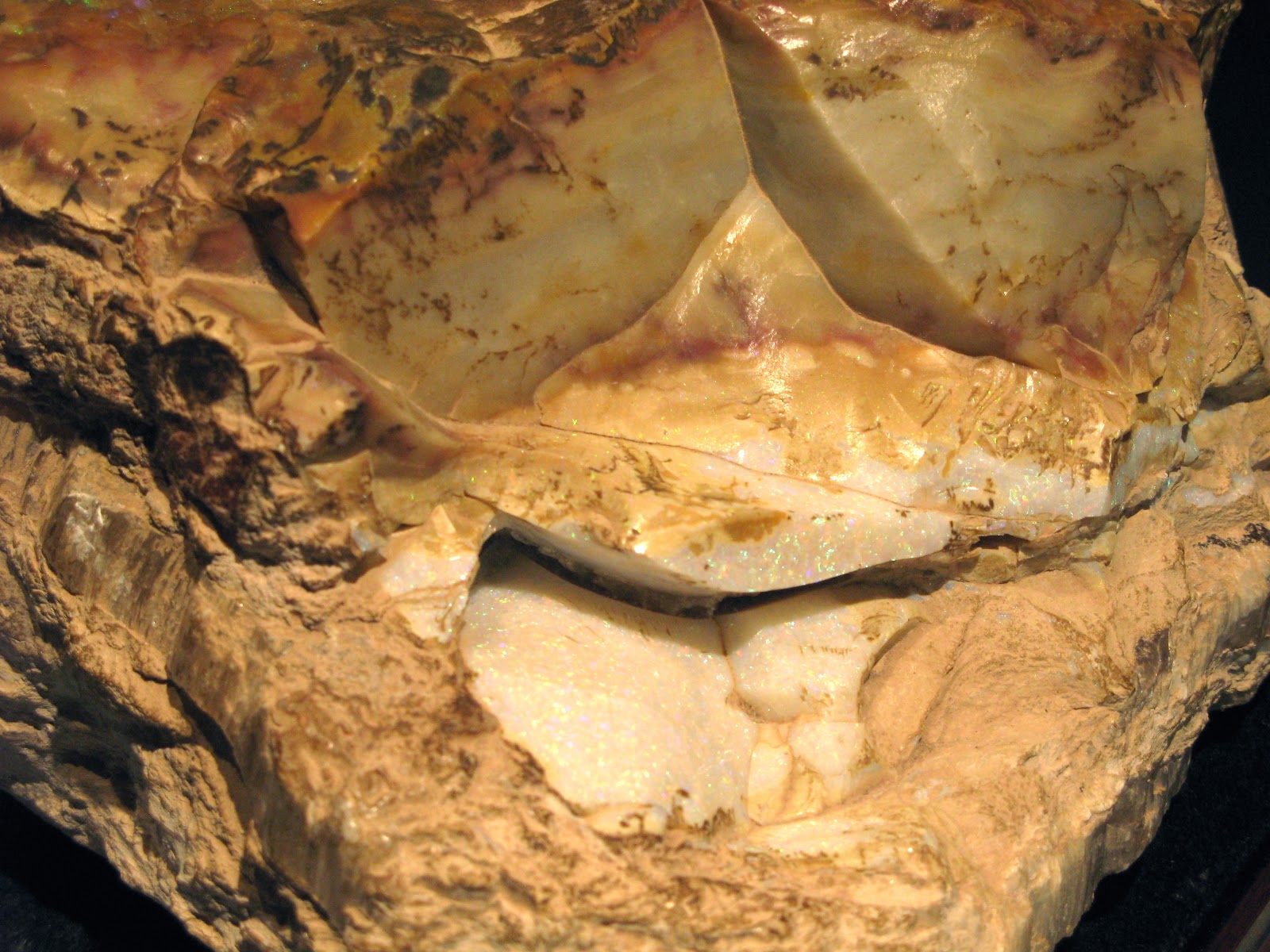
This is what they are after, the elusive opal. The opal fields were formed as a result of this area being part of a huge inland sea at one time. The silica from the sand in the sea liquified, and flowed into the cracks in the subsurface. Miners have learned that the opals can be anywhere from 4 feet to 90 feet below the surface, depending upon the ebb and flow of the layers.
A gian opal, uncut....
These pieces were valued at $250.000.00
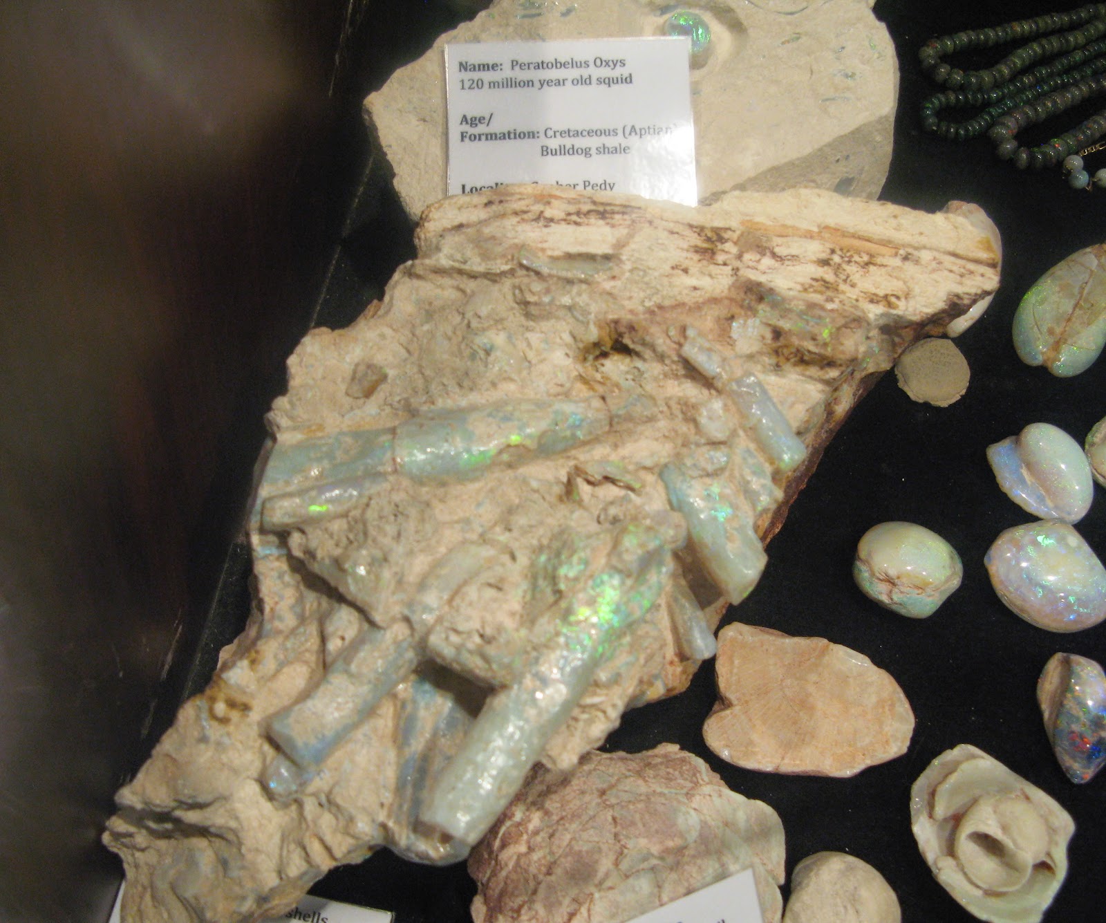
A giant squid, from the inland Sea days decided to eat some fish. They all died, and the fish inside of the squid turned to opals, while the squid ended up being a fossil. Opal fish you might say....
Back on the surface, the barrenness belies the activity below...
Hot, Hot, Hot....
Some bright light invented a huge vacuum machine which will extract the rubble and the opals from the shafts which are dug. The job is then to go through the huge amount of diggings to find those opals...
There were piles of diggings as far as the eye could see.....
Now this is what I would call a road-train....
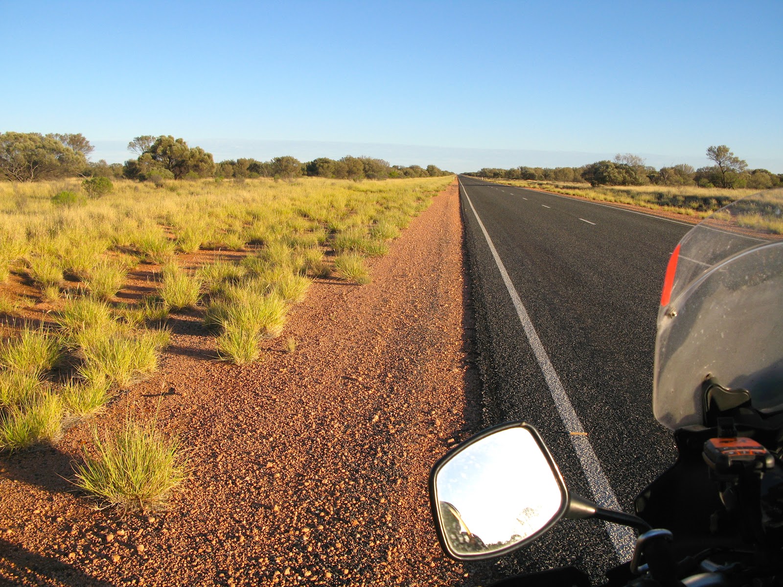
Up early the next day for a lot of long and straight riding. No bulldust, and no kangaroos, so all is good...
This is the same guy who rode with me in South America. Seems a little fatter and older, somehow...
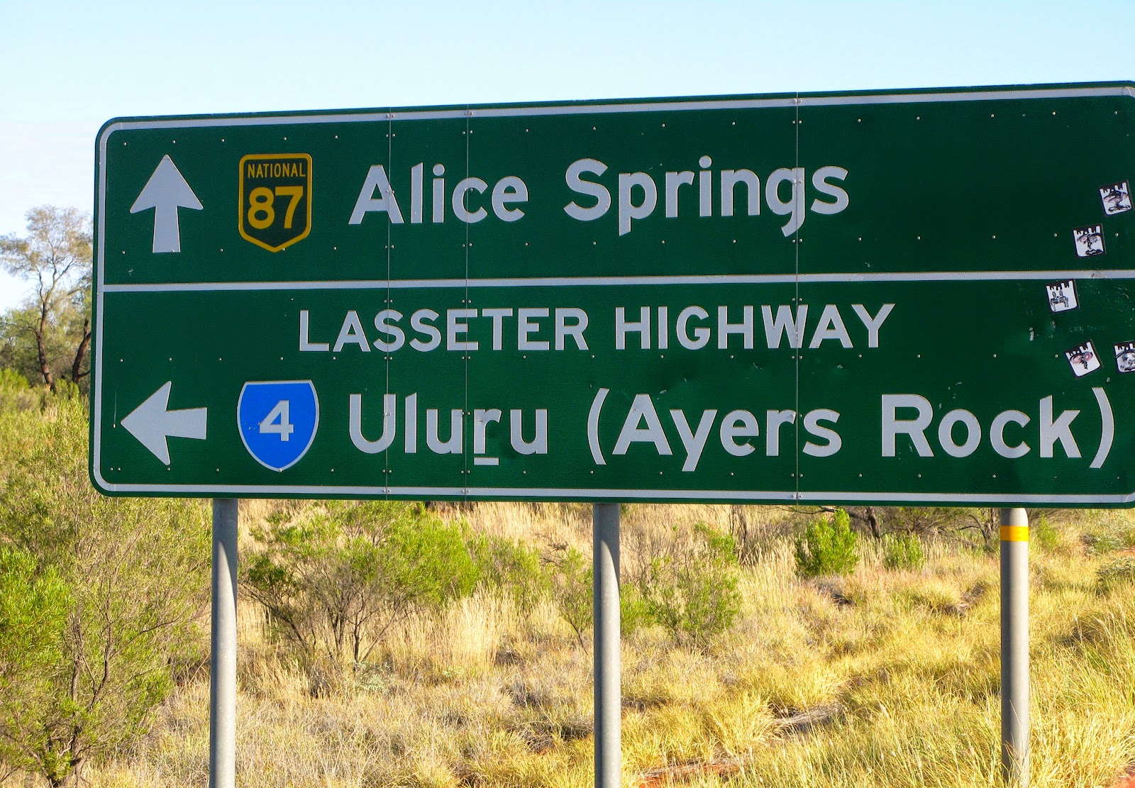
Time to turn west....
Remember: Red is bad....
Uh Oh.....
I do not want to hit a camel, or even smell one....
Yes, I am happy to have reached this goal, believe it or not. Selfies are not what this camera was built for.
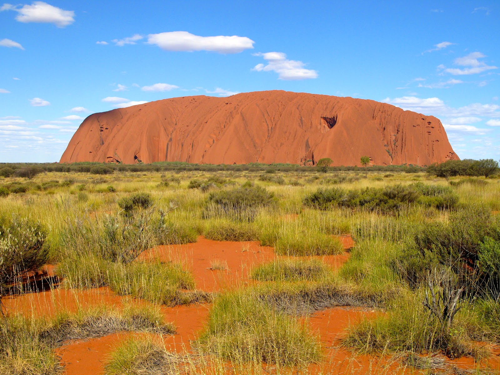
Yes, there are people climbing the sacred monolith, but then again, they probably don't get it...
Some young, hip, tatted and pierced tour guide decided the old guy with the motorcycle needed his photo taken....
There is that shadow again....
These are the Olgas, nearby and just as spectacular....
Only a few flies on me....
I decided to travel the Oonadatta track as it would take me easterly from the main highway, and as well it would touch upon the country that would be as close to the Burke and Wills path north as I was going to get. Also, the brand new Heideneau rear tire and the TKC 80 front tire needed some dirt to round themselves out, or so I thought. I talked to an old stockman about the route, and aside from warning me about the sand, bulldust, and heat, he said that I should be okay. Hmmn..bulldust: that sounds interesting I said to myself.
I scanned the horizon for Caribou, but not a one was seen. This has to be the most southerly Inukshuk I have seen so far...
The old Ghan railroad ended here and this engine is all that remains of headier days....
Somebody has way too much time on their hands, or perhaps has trouble keeping those birds in the air..
On the edge of Lake Eyre was a well developed map of the entire eastern region of Australia. It clearly shows that without the presence of the Great Artesian basin, this area would be drier than it already is, and certainly unable to sustain the large cattle and sheep stations which are absolutely huge.
In the 60's Donald Campbell, of Bluebird fame, brought his machine and 100 of his best buddies to this remote area of the world so that he could capture the world record for Land Speed.
I was easily 1000 km's from the Burke & Wills Dig tree, not to mention it was all dirt and who knows for fuel....
I didn't make it to the Salar de Uni in Bolivia, but I think that Lake Eyre is a satisfactory alternative..
These roads are straight, which is a good thing..... the trucks build up the gravel and marbles on the corners, and it makes for some clenched teeth riding...
No road trains out here, and the good news is that one can see the dust coming miles ahead of the vehicle. There was only two for the whole day, anyway...
Although I have given up the grog, I was very happy to see the William Creek Hotel sign. It had been a long day of intense riding, and I was glad to find a camping spot and a shower as a bonus.
These dead cats are all that is left of a movie shot nearby, and they are not real....
For my son the pilot. Just about every station that I have seen has a couple of fixed wing aircraft, and in most cases a chopper. These big ones are for tours, while the mustering of sheep and cattle with helicopters is from the small one-man birds..
In the days when men were men, and horses were bullocks, this old wagon must have seen some wicked tracks.
Williams' Creek is north of the famous Woomera range, where the Aussies, (and others) fired off rockets and other sky-piercing events into the empty (well, except for the Aboriginals, who weren't always informed) desert....
Hello Jon and Peter. Hello Uli....
Hello Dan and Lissa, over there in New Zealand...
The interesting piece, for me, was that ordinary blokes recovered these pieces of militaria. I guess the locals knew how to get back home from the hinterland.....
There is a lot to be said about the men who made wagons to last....
These cockatoos surrounded the station with a raucous chatter, finally exploding in a roar as they settled in for their roost for the night.
The next days' agenda was layed out for me: Coober Peddy and the wonders of the opal fields..
I was apprehensive that Day 2 of my dirt experience was going to be a repeat of Day 1: lots of bulldust and corrugation. Anytime I saw the road turn to red, I knew that there were hidden dangers in the dips in the road. The red earth seemed to be able to hide the signs of the road, and some of the corrugations caused by the big rigs were absolutely bone-rattling. I worried for the shocks, having killed a shock with Blondy, I did not want to have the same issue out here in the Outback.
Red is bad.....
Thank God for the GPS. There is no way I could tell North from South, let alone East from West....
Some bush tucker that grows beside the road. I don't know what the small round fruits are called, and they reminded me of freaked out watermelons...
In order to survive the ride, I disciplined to stop every 30 minutes or so, have some water, and get off the bike. Although the ride was a little over 200 km, it seemed like the day was going on for a long, long, time...
As the road builders scrape the Mother Earth, they lift the skin enough to reveal the red and white coverings of the Outback. The red earth seems to be sandier, with more bulldust and potential for tank slappers. On the other hand, the whiter portions of the track seem to be harder, with less sand and more structure to the road surface. It also seemed that I was better able to read the road when the underlying surface was more white in colour...
Finally, the dirt gave way to the Stuart Highway. I was honestly grateful for the hard surface, and reminded myself, yet again, that heavy-laden bikes and dirt do not always mix in a satisfactory manner...
I was off to see the wizard of Opals....Coober Peddy...
An amazing collection of dreamers and doers, all gathered together with the dreams of getting rich and striking that elusive vein of opals...
There were literally thousands of open holes throughout the landscape. Some were near the tailings from the mine, while others were simply airshafts to the mines which could be 90 feet below..
A tourist fell down one, and now there are signs. (note the walking backwards while photographing sign)
I toured an former mine which had been made into a museum. The fellows originally had to pick axe their way down to the seams of opals..
In the 50 and 60's people realized that living below ground was a simple and effective way to beat the heat....
There are tunnels all over the place, although the town council will not allow mining within the city limits now....
Nowadays, a boring machine drills the orginal downshaft and a disassembled digging machine is lowered down into the mine. The machine is rebuilt below ground, and then the digging begins.
This is what they are after, the elusive opal. The opal fields were formed as a result of this area being part of a huge inland sea at one time. The silica from the sand in the sea liquified, and flowed into the cracks in the subsurface. Miners have learned that the opals can be anywhere from 4 feet to 90 feet below the surface, depending upon the ebb and flow of the layers.
A gian opal, uncut....
A giant squid, from the inland Sea days decided to eat some fish. They all died, and the fish inside of the squid turned to opals, while the squid ended up being a fossil. Opal fish you might say....
Back on the surface, the barrenness belies the activity below...
Hot, Hot, Hot....
There were piles of diggings as far as the eye could see.....
A full days ride got me further down the road north, now heading for Uluru. It seems that the Australian army like the Outback for manuevers.
Now this is what I would call a road-train....
Up early the next day for a lot of long and straight riding. No bulldust, and no kangaroos, so all is good...
This is the same guy who rode with me in South America. Seems a little fatter and older, somehow...
Time to turn west....
Note: no animals were harmed in the phototaking process of this blog. These shots are for my Armstrong tribe, and anyone else under 5.
Can you say: "Goanna?"
You would think that would be it, but it isn't...Mount Conner...
Remember: Red is bad....
Uh Oh.....
I do not want to hit a camel, or even smell one....
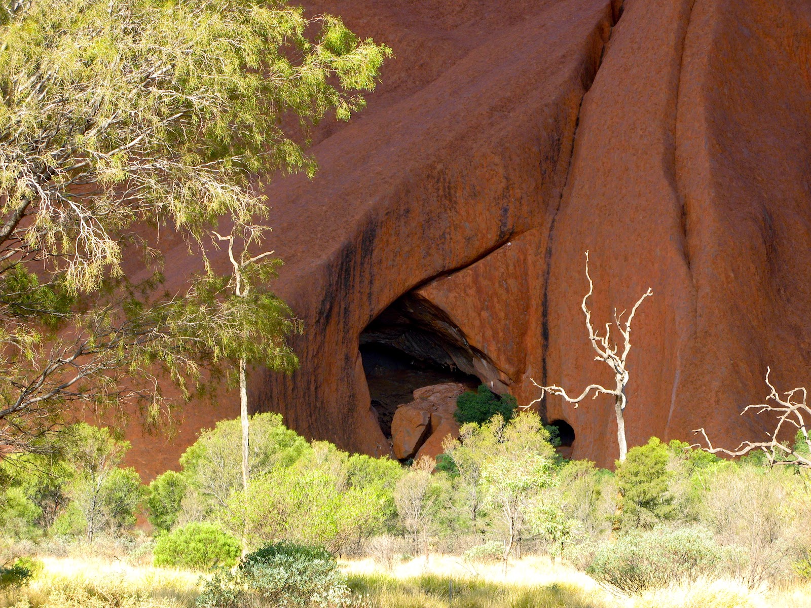
Here it is.....(warning: there are far too many shots of Urulu for some folks, but for others...enjoy)
Yes, I am happy to have reached this goal, believe it or not. Selfies are not what this camera was built for.
Some young, hip, tatted and pierced tour guide decided the old guy with the motorcycle needed his photo taken....
There is that shadow again....
These are the Olgas, nearby and just as spectacular....
I am blessed with having the best journalist/editor on this planet in my tribe. I am double-blessed with having extraordinary photographers throughout my clan. I helped spawn the IT genuis in our crew....unfortunately none of them are with me, except in Spirit. What you get is what you see....


